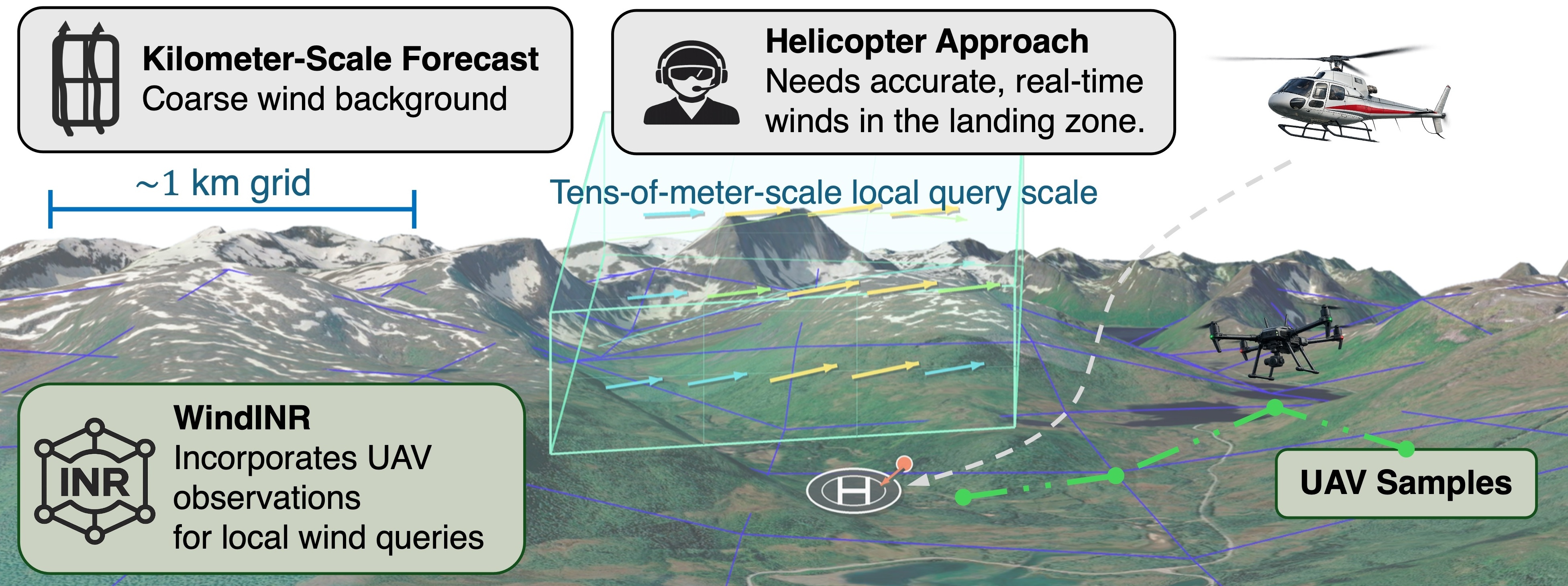


In an interdisciplinary project involving machine learning experts, drone and helicopter pilots, WindINR is developed as a framework for continuous high- resolution local wind query and sparse-observation correction. The method combines specialized neural networks, surrogate high-resolution truth from computational fluid dynamics (CFD) simulations, and a method for assimilation of in-situ wind observations.
Operational weather products are usually delivered as gridded analyses and forecasts, but many decisions in complex terrain require only a small number of fast, accurate wind estimates at user-specified locations. During a helicopter approach, for example, the relevant question is often not the full wind field over a large domain, but the local gusts and potential turbulence along an approach corridor and around a landing zone. This provides support for situational awareness.
These local winds can vary strongly because of terrain- induced channeling, ridge acceleration, land–sea contrast, and boundary-layer structure. Sparse new observations from drones/UAVs or stations may also arrive immediately before the decision. The desired operating point is therefore not simply another dense high-resolution forecast, but a local wind-state estimator that can be queried continuously and corrected quickly.
Our new innovation WindINR provides continuous high-resolution local wind queries with the ability for sparse-observation correction. The method combines implicit neural representation networks, physical numerical simulations, and in-situ assimilation of in-situ wind observations. The aim is for the in-situ observations to be drone/UAV acquired within a context of aviation, e.g. for helicopter search and rescue.The project is a collaboration between UiT The Arctic University of Norway, EPFL, MBZUAI, and Tsinghua University.